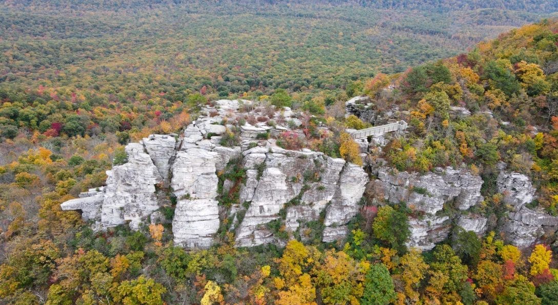
Autumn foliage across the Shenandoah Valley from Tibbett's Knob
EXPLORE · EIGHT HIKES WITHIN HALF AN HOUR

Hiking from the Door

Basye sits in a notch between two mountains, and the George Washington National Forest starts where the neighborhood ends. West of the house, Great North Mountain carries the Virginia–West Virginia line and the ridge trails that run along it. East, across the valley, the Massanutten throws up its own outcrops above Edinburg Gap. Between them there's everything from a fifty-minute lake loop the kids can do in sneakers to a rock-scramble summit with two states in the view. Here are eight, closest first.

Where the trails sit around the homes

RT 263 → I-81 GREAT NORTH MOUNTAIN VA / WV LINE MASSANUTTEN MOUNTAIN THE HOMES · BASYE 1Lake Laura loop 2Orkney Springs 3Falls Ridge 4Laurel Run circuit 5Nutmeg Point 6Big Schloss 7Tibbet Knob 8Copernicus Ridge WOLF GAP REC. AREA

Schematic — positions are relative, not to scale. Numbers match the hikes below.

Show
The wooded loop trail around Lake Laura
01

Lake Laura Trail Loop

~5 min drive
  • Easy
  • 2.3 mi loop
  • 196 ft gain
  • ~50 min

The one everybody can do. A flat, shaded circuit of the resort's 44-acre lake, with the beach and the boat launch at one end and quiet water and birdsong at the other. Perfect before breakfast, or as an after-dinner walk in long summer light. Note that dogs aren't permitted on this one — take the pup up Falls Ridge instead.

The ridge line above Orkney Springs
02

Orkney Springs & North Mountain Loop

~10 min drive
  • Hard
  • 7.3 mi loop
  • 1,729 ft gain
  • 4–4.5 hrs

The big day out that starts practically next door. From the trailhead off Alum Springs Road by Shrine Mont, the Orkney Springs Trail climbs to the North Mountain Trail riding the state line, then drops and runs the base of Powder Springs Mountain back around. Stretches get overgrown and thorny by midsummer — long pants and trekking poles earn their keep here.

The waterfall on the spur off Falls Ridge Trail
03

Falls Ridge Trail (#572)

~10 min drive
  • Hard
  • ~5.5 mi to the ridge
  • Waterfall spur
  • Yellow blaze

The local's pick, and the one with the waterfall. The yellow blazes climb steadily toward North Mountain and the West Virginia line, with views out over the Falls Run valley as you gain height. About halfway up, a spur breaks left to a 60-foot fall that most visitors never hear about. Go to the water and turn around for a good half day, or push on to the North Mountain and Stack Rock junction.

High meadow along the North Mountain Trail on the Laurel Run circuit
04

Laurel Run Circuit

~10 min drive
  • Hard
  • 6.6 mi loop
  • 1,781 ft gain
  • ~3 hrs 45

The most climbing of anything close to home. Stack Rock switchbacks steeply up to the ridge, where the North Mountain Trail runs past high meadows and a pond near the top, and the blue-blazed Laurel Run Spur brings you home. One quirk worth knowing: the gate on Laurel Run Road may be open or shut with no posted schedule. Shut means parking there and walking an extra 1.1 miles each way — open means you can drive to the junction and cut 2.2 miles off the day.

The overlook at Nutmeg Point above the Shenandoah Valley
05

Nutmeg Point

~15 min drive
  • Moderate
  • ~4 mi out & back
  • Overlook
  • Half day

The one where you can see the house from the top. From a small pull-off on VA 720, the North Mountain Trail runs north about two miles through moss-floored woods and a stand of pines to an overlook that takes in the Massanutten range, Shenandoah National Park beyond it, and the ski runs at Bryce below you. Quiet on almost any day — a good sunset walk if you time the return with light to spare.

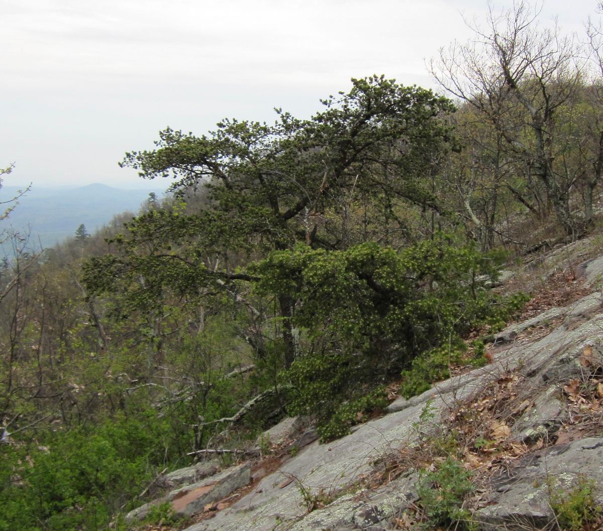
A Table Mountain Pine on the rock slabs of Big Schloss, with the ridges falling away beyond
06

Big Schloss via Wolf Gap

~30 min drive
  • Moderate
  • 4.3 mi out & back
  • 1,053 ft gain
  • 2–2.5 hrs

The famous one, and worth the drive. A steep first half mile out of Wolf Gap settles into a steady ridge walk, ending at a footbridge onto a castle-like rock outcrop — Schloss is German for castle — with a 360-degree view over Virginia on one side and West Virginia on the other. It carries a 4.8-star rating across thousands of AllTrails reviews for a reason. Go early on fall weekends; the small lot at Wolf Gap fills.

Rock scramble near the summit of Tibbet Knob
07

Tibbet Knob

~30 min drive
  • Moderate
  • ~3 mi out & back
  • 670–940 ft gain
  • ~2 hrs

Big Schloss's quieter neighbor, leaving the same Wolf Gap lot but heading south instead. Shorter and rockier — two genuine hand-on-rock scrambles near the top that kids tend to love and that give the summit its outsized payoff for the mileage. If the Big Schloss lot is packed on a Saturday, this is the answer. Sources differ a little on the exact distance and climb; it's a solid two hours either way.

Rock outcrops on Copernicus Ridge above Edinburg Gap
08

Copernicus Ridge

~30 min drive
  • Hard
  • 3.4 mi
  • 869 ft gain
  • 2–2.5 hrs

The other mountain. Cross the valley to Edinburg Gap and pick up the orange-blazed Massanutten Trail, which climbs to a run of outcrops looking back over the gap and across to Waonaze Peak on Powell Mountain. Short on paper and steeper than it reads — a good half-day when you want a different view from the one you've been looking at all week. Parking at Edinburg Gap, then about half a mile to the trail proper.

Know Before You Go

A few local notes

Signal drops fast

Cell service thins out within a mile of most of these trailheads. Download your AllTrails map for offline use before you leave the driveway — the house Wi-Fi is quick.

Forest roads & gates

Several trailheads sit at the end of gravel forest roads that wash out after storms and can close seasonally. The Laurel Run gate is the one that catches people; check before you count on driving through.

Ticks, spring to fall

The valley has them. Long socks, a repellent with permethrin or DEET, and a check when you get back to the house. There's an outdoor shower at both homes for the muddy version of the same problem.

Bears live here

Black bears are common in the George Washington National Forest and almost always uninterested. Make a little noise on blind corners, keep food packed away, and never leave a cooler out at a trailhead.

Best months

April through June for wildflowers and full streams, October for the color. Midsummer brings heat and overgrowth on the ridge trails; winter opens up the views but expect ice on the north-facing climbs.

Dogs

Both homes are pet-friendly and so is most of this list — the exception is the Lake Laura loop, where dogs aren't permitted. Falls Ridge and the Wolf Gap trails are the good long ones with a dog.

Distances, elevation, and times come from AllTrails, Hiking Project, and the Forest Service; drive times are approximate from Aspen Way South. Trail conditions change — check a recent trip report before a long day out. There's more than we've listed here: browse every trail near Basye on AllTrails, or the George Washington & Jefferson National Forests for the full map.

Big Schloss photograph by Chris M, used under CC BY 2.0 (via Wikimedia Commons). The other cards show a schematic of each trail's distance and climb rather than a photograph.

Boots by the Door

Base yourself at Bryce

Two homes side by side on Aspen Way South, with the national forest at the end of the road and a hot tub for afterward.

CHECK AVAILABILITY